
Territorial evolution of Mosquitia
The territorial evolution of Mosquitia describes the historical development of the borders and jurisdiction of Mosquitia. The BOUNDARIES of Mosquitia have been recorded across Spanish, British, ecclesiastical, and indigenous sources, forming a consistently recognised country from as early as the 18th century. Its extent was defined both by natural geographic features—rivers, mountains, and coastlines—and by political control, treaties, and settlements. From the earliest description in 1576, the Mosquitian territory was understood to extend southward as far as the Desaguadero or River San Juan, from “as far as Cape Camarón, in the same direction where the Province of Honduras begins, with all the territories towards the interior, as far as the actual boundary and jurisdiction of the Province of Nicaragua and New Segovia and that which belongs to that of Honduras." This territorial definition changed during the 1730s, when Mosquitia's effective sphere of authority expanded further south. 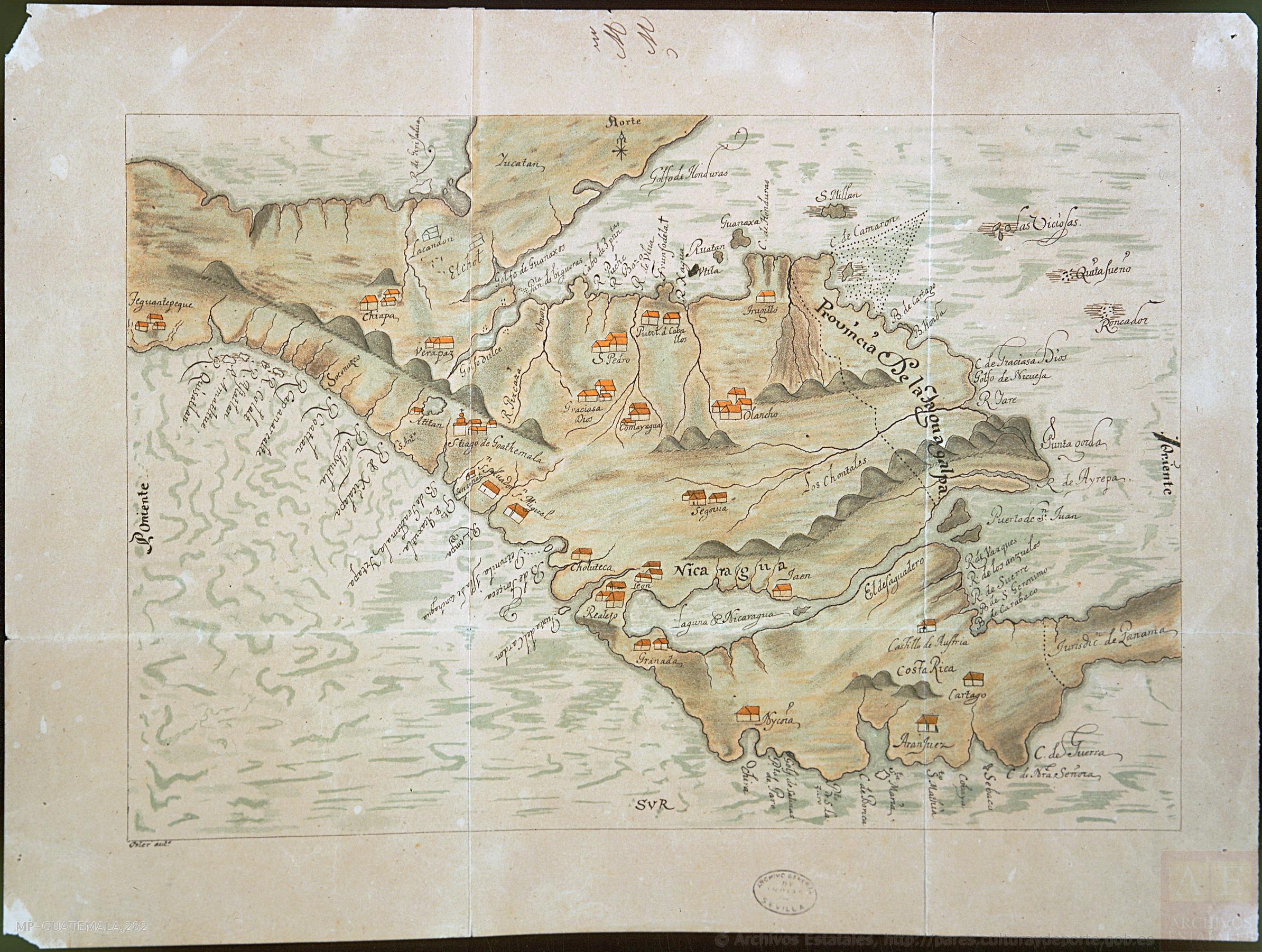 By 1737, Spanish local authorities described that the area inhabited by the Mosquitian people extended to the river and valley of Matina (Moin), reflecting the kingdom's growing presence along the Caribbean Sea. In 1739, July 8, the Council of the Indies issued a report formally describing the territorial extent of the Mosquitian domain as extending more than sixty leagues along the Caribbean Coast between the jurisdictions of Comayagua and Costa Rica. The Council explicitly distinguished Mosquitia's territory from “the dominions of His Majesty,” identifying the Amerrisque Mointains as its western limit, which is “the slope of the mountains that separate them from the dominions” of the Spanish Crown — a definition that would later delineate the frontier with what became known as the “Spanish continent”. This wording effectively constituted a de facto recognition of Mosquitia as a distinct political and territorial entity, since the acknowledgment of a distinct territorial jurisdiction in early modern legal practice implied recognition of an independent jurisdiction beyond it.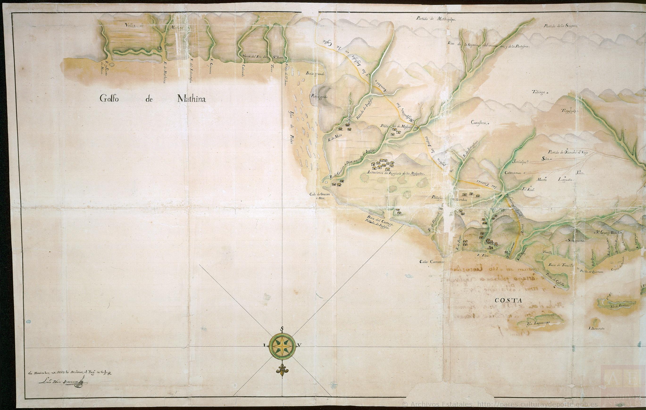
In 1757, British sources described the entire Caribbean littoral from Cabo Castile to Boca del Toro as being under the effective control and vassalage of the Mosquitian monarchy, confirming its consolidated territorial extent. The following year, in 1758, King George I and Governor Timothy Briton expanded their conquest of the Boca Toro region as far as the River Chagres, which the Spanish later recognised in 1803 as being “in the power of the Mosquito Indians.” 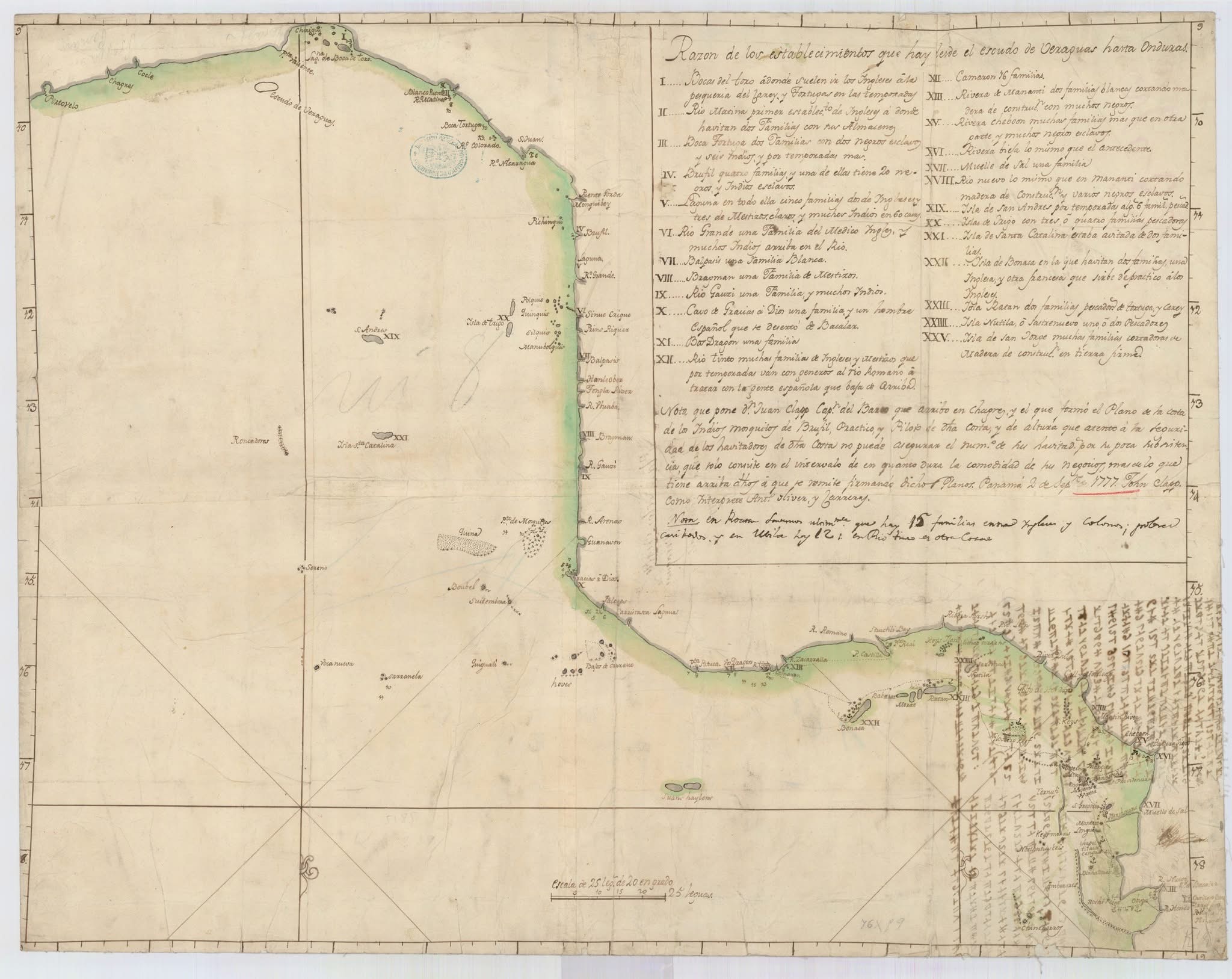
Finally, in 1847, the British Government reaffirmed Mosquitia's historical boundaries in an official communication to the Central American republics, stating that it was “of opinion that the right of the King of Mosquito should be maintained as extending from Cape Honduras down to the mouth of the River San Juan; without prejudice to the right of the Mosquito King to any territory south of the River San Juan.” This assertion was grounded in long-standing historical and political evidence established through the Mosquitian monarchy's own agency.