
Porto Salvo (Gaeta)
Porto Salvo, also called Borgo di Gaeta, formerly Elena, is a district of the municipality of Gaeta, in the province of Latina, southern Italy. Located along the Tyrrhenian coast, it developed outside the ancient city walls from the 8th century onward, growing as a maritime and agricultural community. Today, the neighborhood retains a strong seafaring identity and is home to several notable historical and archaeological landmarks, including Baroque churches, Roman mausoleums, and a scenic coastal promenade.
History
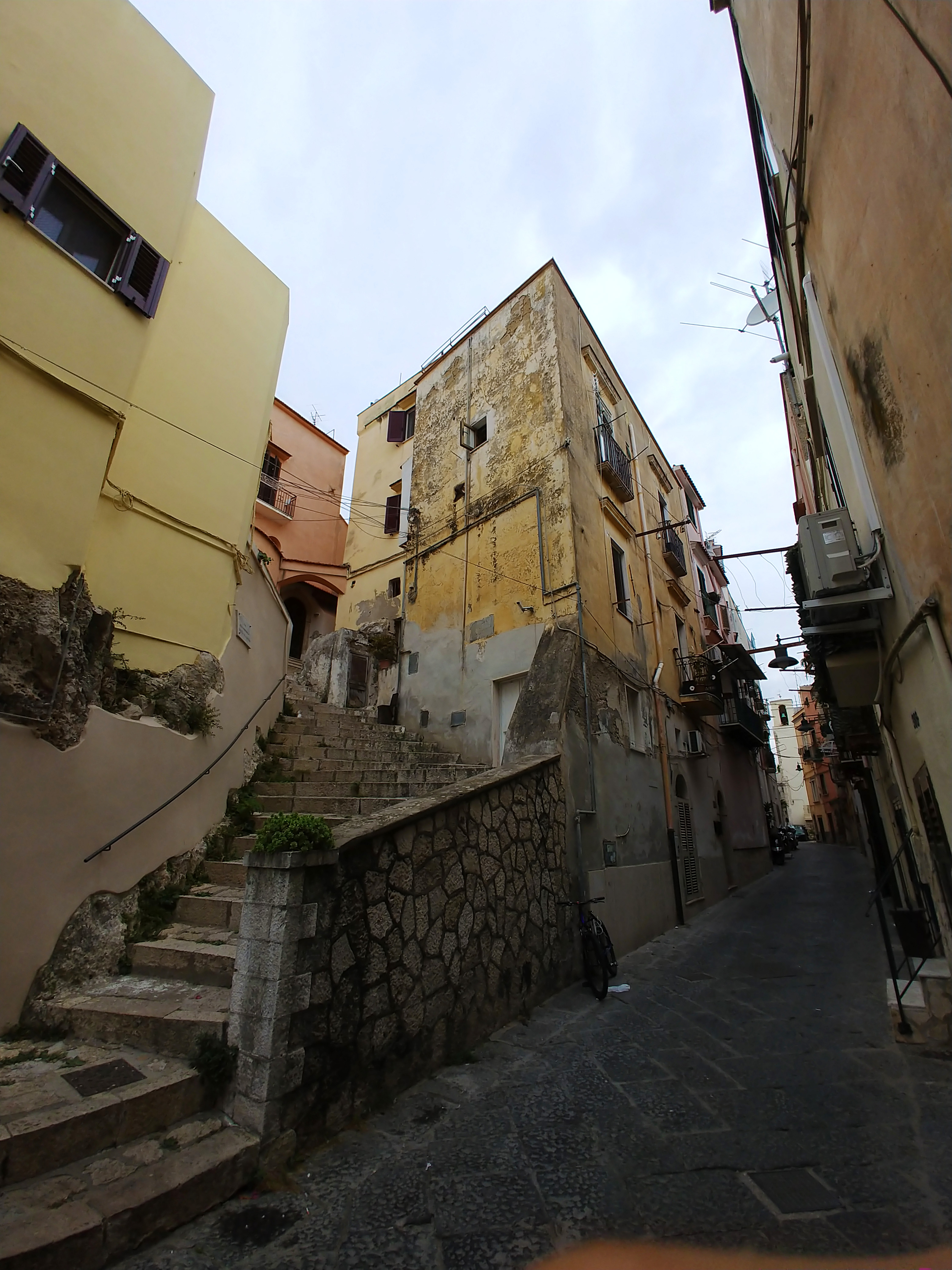 The area where the neighborhood of Porto Salvo stands was home to several Roman villas, including those of Emperor Antoninus Pius (on the western side of the Montesecco isthmus), Lucius Sempronius Atratinus (in the upper part of the current neighborhood), and Lucius Marcius Philippus, stepfather of Octavian Augustus.
The settlement began to develop outside the walls of Gaeta in the 8th century, under the name Borgo Nuovo, to distinguish it from Borgo Vecchio, which had arisen in the contrada of Ariccia (or Tesa), behind the current former Sanctuary of the Santissima Annunziata. It was only in the 16th century that the district expanded northward, with the construction of a defensive tower—the torre della Catena ("Tower of the Chain"), commonly called the castello ("castle")—at the foot of the Cappuccini hill. In the following century, it reached the base of the Sant'Agata hill (an area later known as Piaja, meaning "beach").
The population of the Borgo consisted mainly of sailors, fishermen, and farmers. A key element of the local economy was olive cultivation and the export of Gaeta olives: in the 19th century, moggi (an ancient unit of area) throughout the Gaeta territory were dedicated exclusively to this crop. Rope was also exported, produced from high-quality broom grass typical of the area. The shipyards, once numerous in the locality, had for centuries built the city's commercial fleet and also exported vessels. This production entered a crisis when demand for large wooden ships declined.
The oldest church in the Borgo was that of Saints Cosmas and Damian, built at the end of the 8th century (and equipped with its own baptismal font in 1591). In 1571, the church of San Giacomo Apostolo was built and established as a parish. In 1606, the parish of San Carlo was founded in the Piaja district, to which the church of Sant'Andrea in the Calegna area was annexed—this church had previously served as a chapel of ease for the parish of Saints Cosmas and Damian. Another parish was that of San Sergio, a church already existing in 1375, located at the southern end of the Borgo. Starting in 1639, due to the poor condition of that temple, the community gathered at the church of Santa Maria di Torre d'Oria (near the present-day Carlo III gate) and later merged into that of the Santi Apostoli, a church consecrated in 1711.
upright=1.4|thumb|left|The Lungomare Giovanni Caboto, formerly Corso Attico, opened in 1852 and later widened. In 1852, the high ground of the Montesecco isthmus was leveled (with the demolition of the churches of San Sergio and Santi Apostoli), and a major new thoroughfare was opened, skirting the outside of the settlement parallel to the coast—this is the current Lungomare Giovanni Caboto, which in 1872 acquired the name Corso Attico. In 1872, the Borgo received its first official name, Anatola, and was divided into three districts running south along the alignment of present-day Via dell'Indipendenza: San Giacomo, San Cosma, and San Carlo, named after the three parishes.
Anatola, separating from the area of Sant'Erasmo (which retained the name Gaeta), became an independent municipality by Royal Decree on March 15, 1897. This push for independence came from liberal figures seeking autonomy from the old administration, which remained tied to the Bourbon past. The separation request, first presented in 1891, received a favorable opinion from the provincial council in 1893; new requests were sent to King Umberto I and Minister of the Interior Francesco Crispi in 1894 and 1895; the request was finally accepted in 1897, and the boundary was set along what was then the road of Madonna della Cappella (present-day Corso Cavour, Via Garibaldi, and Contrada Catena). The new municipality took the name Elena in honor of the then-Princess Elena of Montenegro, future Queen of Italy, and was headquartered in Palazzo di Marzo on Corso Attico.
On May 4, 1892, the Sparanise–Gaeta railway was inaugurated, breaking Gaeta's isolation from major transportation routes. The Gaeta terminus, located on the border between the two municipalities, took the name Gaeta-Elena from 1897 to 1927.
By Royal Decree of February 17, 1927, after a thirty-year separation and following a broad territorial reorganization, the municipalities of Gaeta and Elena were reunited under the name Gaeta.
Monuments and places of interest
Religious architecture
Church of Santa Maria di Porto Salvo
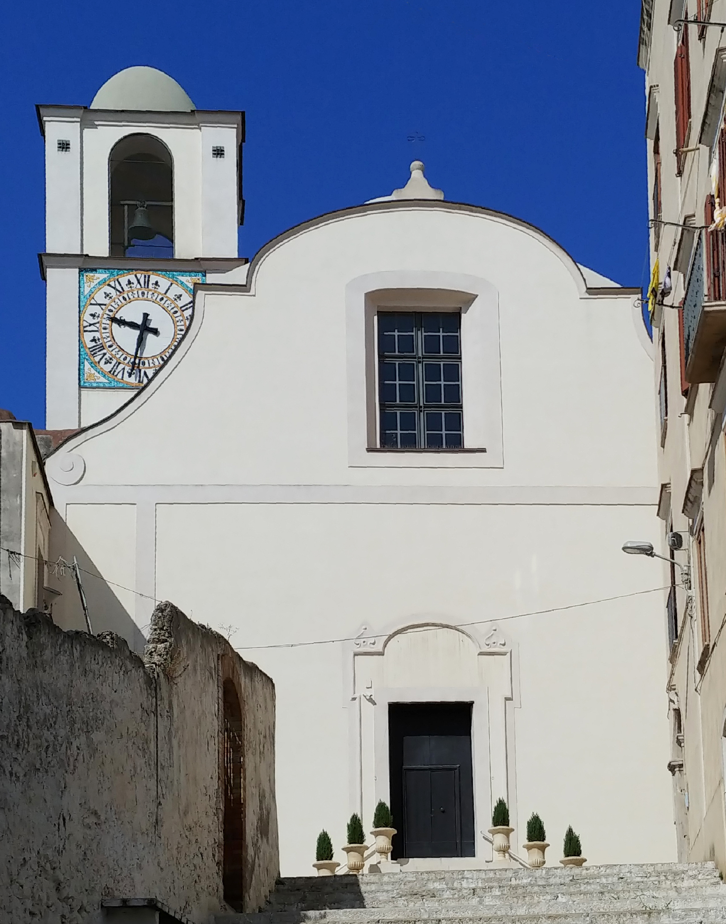
 Located at the top of the scenic Scalzi staircase, this church is also called Scalzi after the Discalced Augustinians who officiated it from 1624 (the start of the complex's construction) until 1809, and dei Santi Cosma e Damiano. The building is in Baroque style and is the work of Jacopo and Dionisio Lazzari, who worked on other churches in Gaeta during the same period. The interior has a single nave, characterized by the chromatic alternation of light blue walls and white stuccoes. The high altar is in polychrome marble, decorated with plant motifs. To the left of the facade stands the bell tower with a clock made of polychrome majolica tiles, visible from the sea of the facing Gulf of Gaeta. Since 1944, it has been the seat of the parish of Saints Cosmas and Damian, transferred from the homonymous church damaged during the war.
Church of Saints Cosmas and Damian
upright=1.4|thumb|Interior of the church of San Cosma vecchio. The church of Saints Cosmas and Damian, also called San Cosma vecchio ("old San Cosma"), is the oldest in the neighborhood, having been built at the end of the 8th century. Subsequently expanded in Gothic style until it took on a single-nave layout with three bays and a square apse, it was restored in Baroque style in the 18th century. During the bombings of World War II, it was half-destroyed and, at the end of the conflict, reduced in length to only the first two bays of the nave. Externally, it features a marble Baroque portal, surmounted by a painted image of the two titular saints, and a tower bell tower adjoining the facade. Internally, it is covered with a groin vault and, within a niche at the base of the bell tower, houses the 1591 baptismal font.
Church of San Giacomo Apostolo
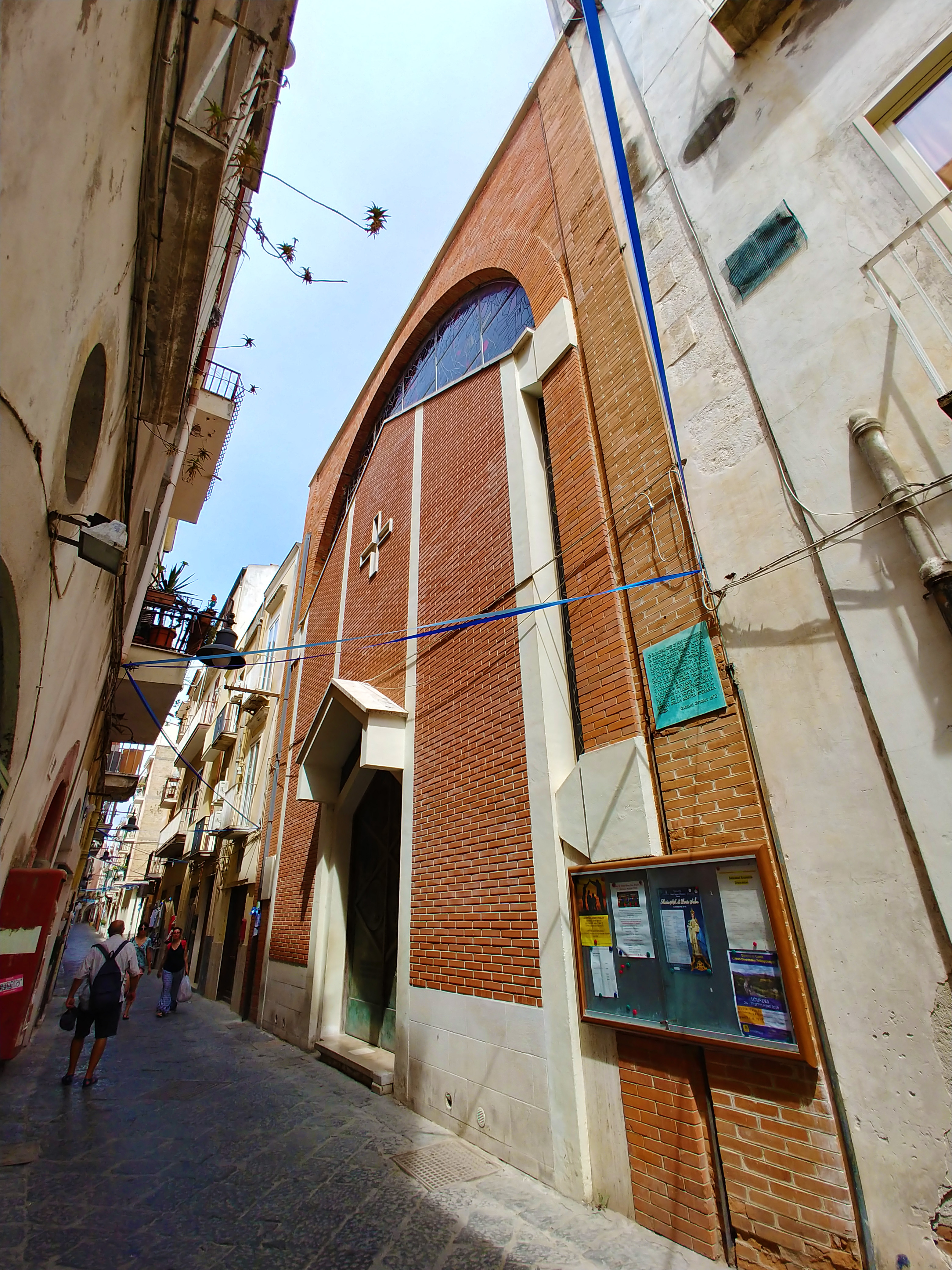 The church of San Giacomo Apostolo is located along the southern stretch of Via dell'Indipendenza. It was built in Baroque style between the 16th and 17th centuries, and in the second half of the 20th century it was modified with the reconstruction of the facade and the creation of a new apse in a modern style. Inside, the church features a wide single nave covered with a barrel vault, along which several slightly projecting side chapels open. Inside the modern apse, which features polychrome stained glass windows, stands the 18th-century marble high altar originating from the church of Santa Caterina d'Alessandria. Its altarpiece, Sacra Conversazione, is located on the right wall of the old apse, opposite the Mascioni pipe organ opus 873; two holy water fonts on the counter-facade also came from the church of Santa Caterina.
Church of San Carlo Borromeo
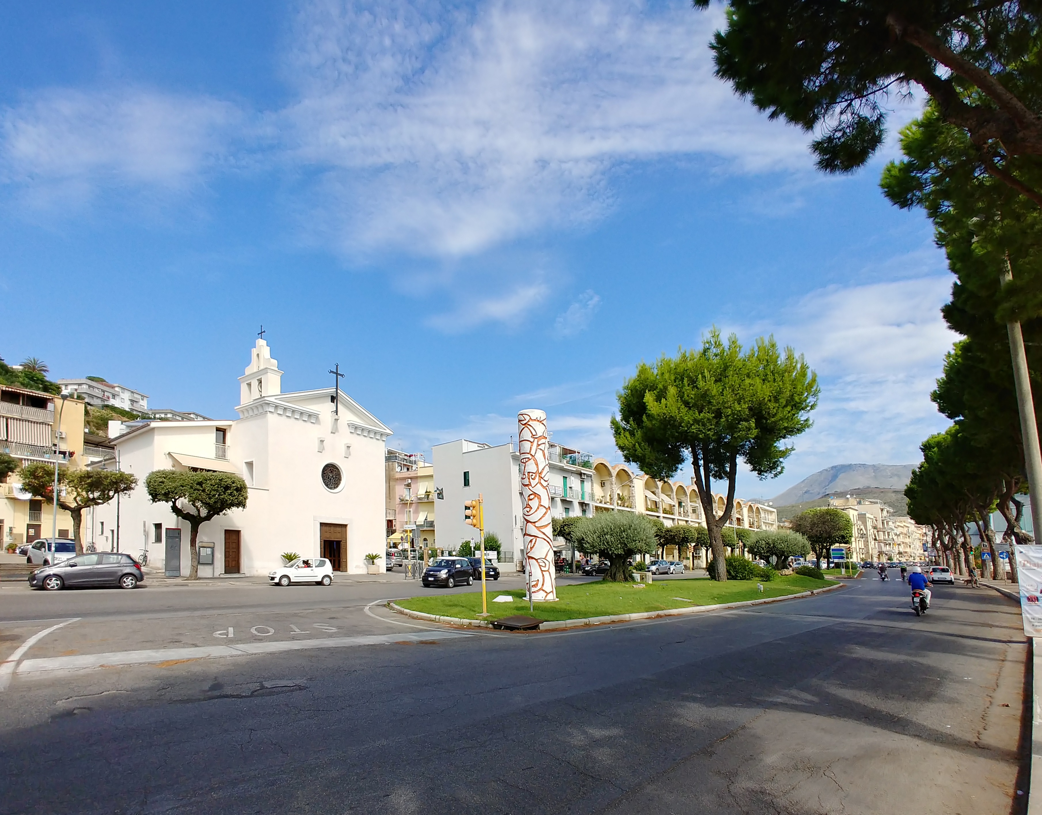 Located in the Piaja neighborhood, along the road to Formia, this church was built in the 17th century and heavily remodeled starting in the mid-20th century, losing all references (with the exception of the structure) to its original Baroque features. Externally characterized by a small bell gable, the church internally presents a single nave covered with a lunetted barrel vault, with shallow chapels without altars, ending in a rectangular apse.
Former Capuchin convent
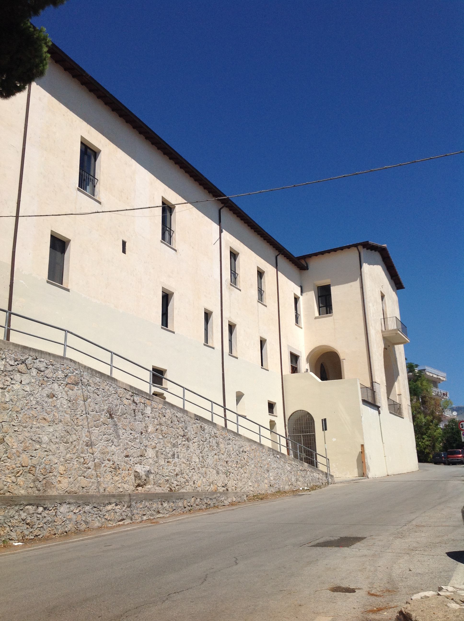
upright=1.4|thumb|right|The former Capuchin convent. On the hill of the same name overlooking the Porto Salvo neighborhood stands the former convent of the Capuchin order, built around 1715 with an annexed church dedicated to Saint Anthony of Padua and a cemetery. After suppression in 1809, it was used as an artillery battery by the Royal Sardinian Army during the Siege of Gaeta (1860), and subsequently, until 1975, as a school building. Between 1978 and 1988, it was partially demolished for the construction of the adjoining Di Liegro Hospital, of which it became an integral part. Currently visible are the cloister, the wing facing the sea, and the single-nave church with a large atrium on the facade.
Civil architecture
Fishermen's houses
The stretch of Lungomare Giovanni Caboto included in the Calegna and Piaja neighborhoods is characterized by multi-story residential buildings commonly referred to as case dei pescatori ("fishermen's houses"), whose main facades feature balconies opening outward with rows of arches. They are the result of post-war reconstruction, carried out largely based on a design by architect Giuseppe Zander on behalf of the Genio Civile, which specifically took care of the houses located near the church of San Carlo Borromeo (originally connected to it by an arch passing over Via Sant'Agostino). These were designed in 1944 and built between 1946 and 1948.
Other
Lungomare Giovanni Caboto
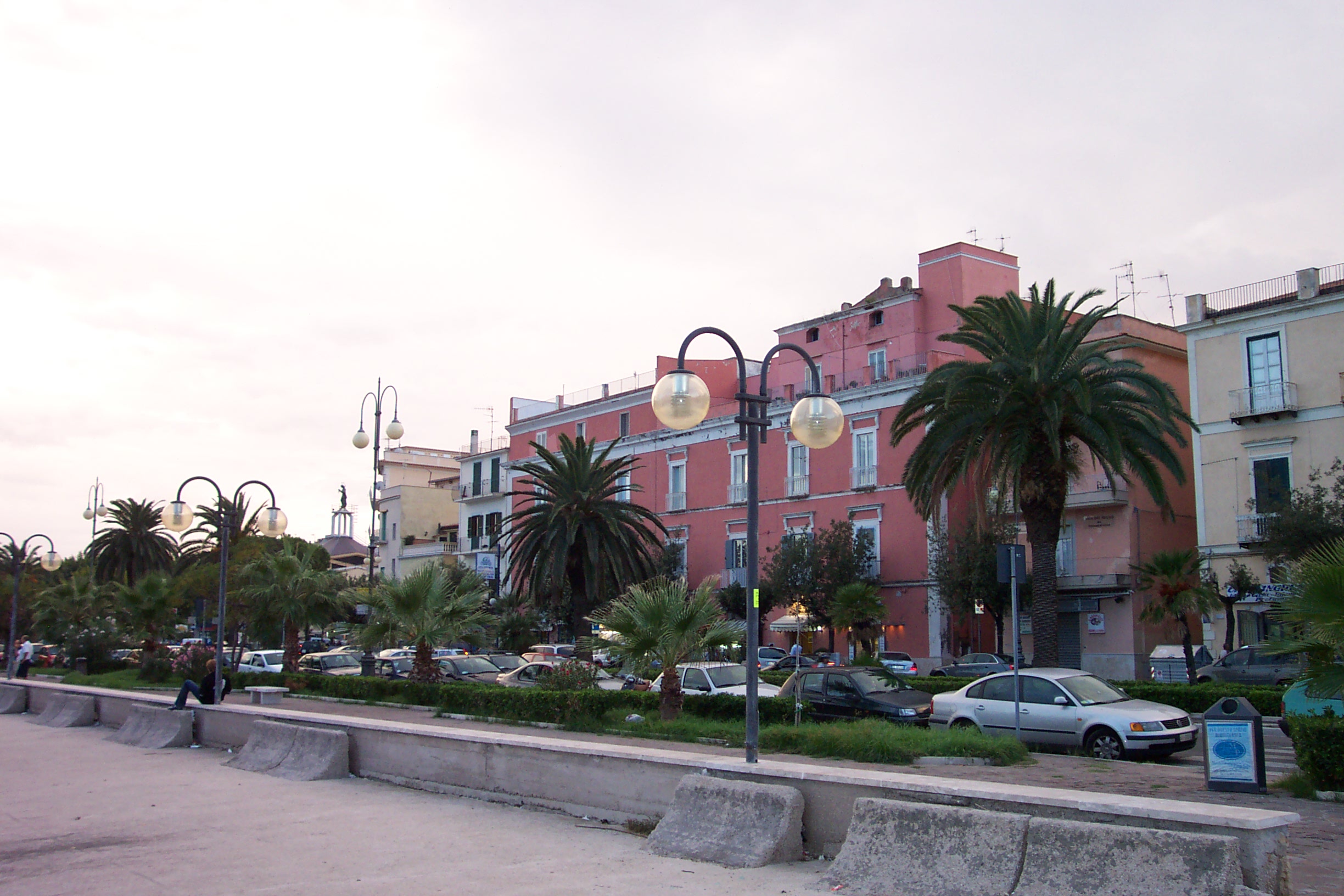
This is the city's main coastal road axis, running from the border with the municipality of Formia (where it becomes Viale Unità d'Italia) to Piazzale Giovanni Caboto in the medieval quarter, passing through (from north to south) the localities of Arcella, Conca, Arzano, and, in the Porto Salvo neighborhood, the contrade of Piaja, Calegna, Mare all'Arco, and Montesecco. It was constructed between 1956 and 1962 by demolishing the sea-front ramparts and incorporating Corso Attico (built in 1852 by King Ferdinand II of the Two Sicilies) and, outside the inhabited center of Gaeta, the route of the Strada statale 213 "Via Flacca". Near the Sanctuary of the Santissima Annunziata is the Monument to John Cabot (1990), while in front of the Carlo V Gate stands the National Submariner Monument (2017).
Salita degli Scalzi
Located in front of the facade of the church of Santa Maria di Porto Salvo, this staircase connects the church to Via dell'Indipendenza, to which it is perpendicular. It was built using part of the external stone cladding of the Mausoleum of Lucius Sempronius Atratinus, following a vow made by the population during the plague of 1656.
Pontone Viaduct
The Pontone Viaduct, commonly called Venticinque ponti ("Twenty-Five Bridges"), takes its name from the stream it crosses near the border with the municipality of Itri and forms part of the Formia–Gaeta railway. It was built in stone in 1890–1891 and destroyed by retreating German troops in 1944, with the exception of the first three arches on the Formia side, and rebuilt in masonry in 1952–1954. The structure consists of twenty-five arches, has a length of 359 m and a maximum height of 23 m.
Archaeological sites
Mausoleum of Lucius Sempronius Atratinus
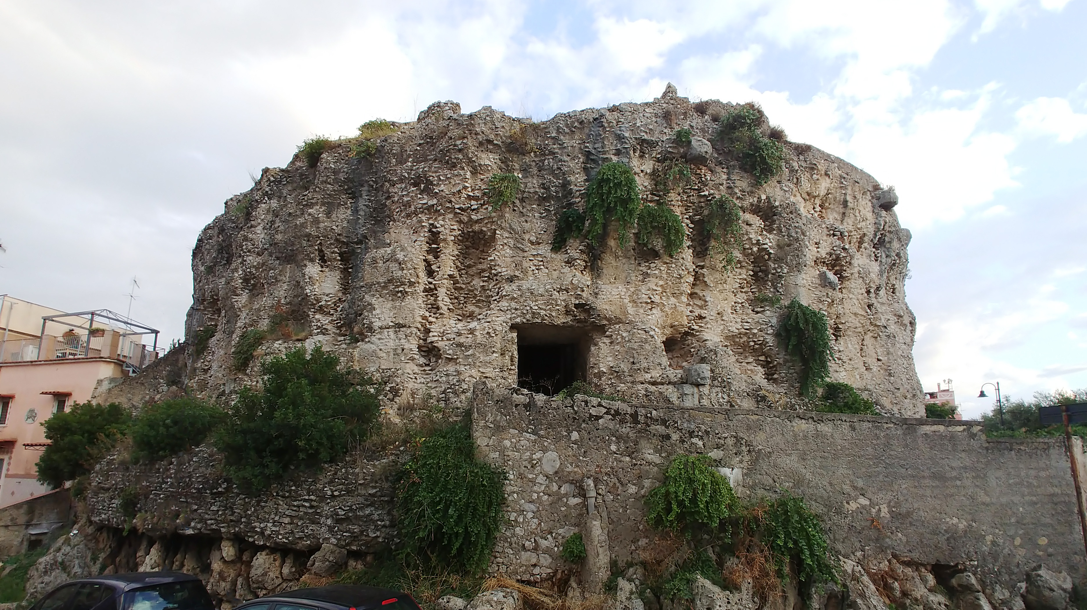
upright=1.4|thumb|The Mausoleum of Lucius Sempronius Atratinus The Mausoleum of Lucius Sempronius Atratinus stands in the upper part of the neighborhood. It is the monumental tomb of Lucius Sempronius Atratinus, a Roman consul who died in 20 BC. Similar in structure to the Mausoleum of Lucius Munatius Plancus on Monte Orlando, it was stripped of its outer cladding of travertine blocks during the Middle Ages, which were used to construct the base of the cathedral bell tower and the Scalzi staircase. It was damaged during the 1815 Siege of Gaeta, when it was used as a powder magazine. The mausoleum has a circular plan, with an annular corridor following the outer perimeter. Inside, arranged in a cross around a central pillar originally surmounted by a small circular tower, are four rooms: three rectangular burial chambers covered with barrel vaults, and an elliptical water cistern lined with cocciopesto.
Maritime tomb
 The so-called sepolcreto marittimo ("maritime tomb") stands in the Calegna neighborhood, in the densely built-up area between Lungomare Caboto and Via Gastone Maresca. Neither its owner nor its date of construction is known (it can be dated to the 3rd century BC); the current remains probably constituted the basement of a circular second floor. The facade is characterized by masonry cladding of squared limestone blocks, decorated on the lower portion with moldings. Inside are two semi-hypogeum rooms: one rectangular (serving as today's entrance) and the other cruciform, covered with a groin vault.
Villa of Lucius Marcius Philippus
Near the border with the municipality of Formia, in the locality of Arcella, are the remains of the monumental villa of Lucius Marcius Philippus, consul in 56 BC and stepfather of Octavian Augustus. In 1907–1912, they were incorporated into the neoclassical villa of Count Stenbock-Fermor, later converted into an accommodation facility. Among the remains are a long cryptoporticus, onto which open a series of intercommunicating large rooms and several exedrae that opened in the villa's ancient boundary wall.
Traditions and folklore
Feast of the Madonna di Porto Salvo
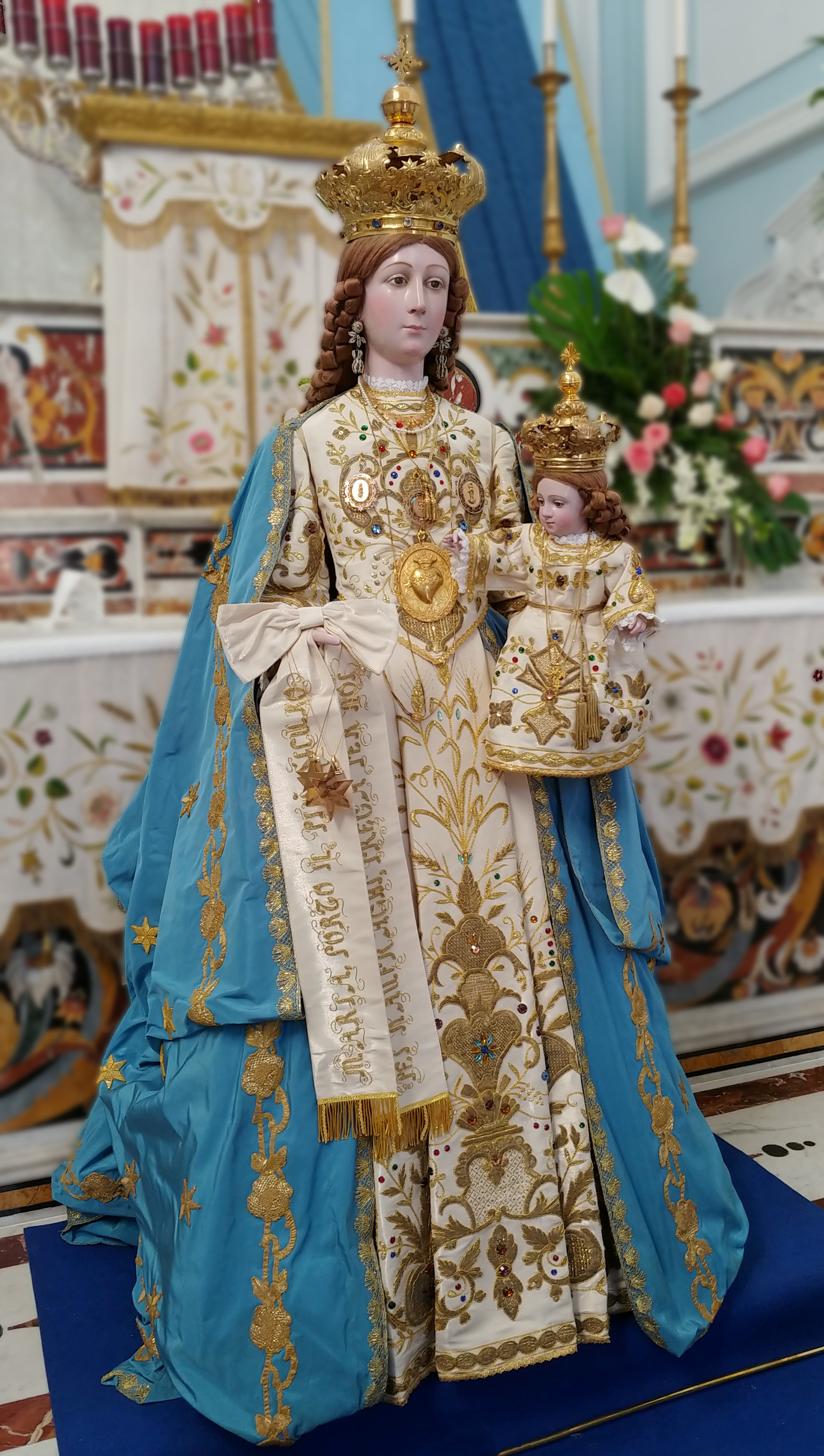
On the second Sunday of August every year, the Madonna di Porto Salvo is celebrated. She is considered the patron protector of mariners, who brings people of the sea safely back to land, and is popularly called Madonna nostra ("our Madonna"). Tradition has it that in 1655, the Madonna appeared to shipwrecked sailors during a storm, coming to their aid. This religious celebration, centered around fishermen and mariners in general, has remained a deeply felt event of communion through the centuries.
On the occasion of the celebrations, a procession takes place on the sea. The statue of the Madonna, covered in gold and clad in her most solemn vestments, is carried aboard a vessel followed by other decorated and flag-draped boats. The procession reaches the area near Punta Stendardo, the tip of the medieval quarter of Gaeta, where a wreath is left in the water to commemorate those who died at sea.


See also
- Gaeta
- Gaeta Cathedral
- Lazio
Bibliography
Elena Category:Gaeta Category:Cities and towns in Lazio Category:Municipalities of the Province of Latina