
Maceta de Cote
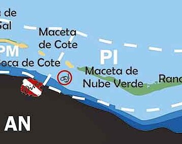 Maceta de Cote or Maceta de Cayo Sal is the name given to an island of 3.4 hectares in Venezuela, located in the Caribbean Sea or Sea of the Antilles, specifically in the Lesser Antilles. Geographically, it is part of the Los Roques Archipelago and administratively it is included in the Miranda Insular Territory and the Los Roques National Park in the Federal Dependencies of Venezuela. It should not be confused with another island with a similar name, Maceta de Nube Verde, located 1 kilometer to the southeast.
History
The island was part of the Captaincy General of Venezuela, and after independence from Spain, it became part of the Colón Territory and later the Federal Dependencies of Venezuela (since 1938) and the Single Area Authority of Los Roques (from 1990 until 2011). In 1972, it became part of the protected area known as Los Roques National Park. In 2011, it was included in the Miranda Insular Territory, which was created by a decree with the rank of Organic Law.
Geography
It is an island of 0.034 square kilometers south of the Ensenada de Los Corales and the Los Roques archipelago itself, west of Cayo Nube Verde and east of Cayo Sal. Like the entire archipelago, it has a mostly warm and dry climate. As part of Los Roques National Park, which was declared a protected area in 1972, Maceta de Cote is under an environmental conservation regime. This means its flora, marine fauna, and coral structure are protected by national laws, which limits direct human and tourist activity on the island.
Although it is not among the most popular tourist destinations in the archipelago, its existence contributes to the geographical and ecological richness of the National Park.
It is an insular key with a narrow and elongated morphology that extends diagonally along a northwest to southeast axis within the Los Roques archipelago. With an approximate area of 3.4 hectares, this small insular formation features an extremely low relief made up of deposits of calcareous sand and coral debris accumulated over time. Its coastal profile exhibits narrow, irregularly arranged beaches, differentially exposed to the impact of waves and the trade winds that continuously shape the sediments of its shoreline.
The aquatic environment surrounding the key is distinguished by a dramatic contrast in underwater topography, characteristic of Caribbean barrier reefs. Towards one of its flanks, the island opens into a system of extremely shallow, crystal-clear, light turquoise waters, where seagrass meadows and protected sand flats abound. On the opposite side, the seabed drops abruptly to deep areas of intense cobalt blue tones, marking the outer edge of the barrier reef where the ocean waves break, acting as a natural shield for the surrounding marine ecosystem.
The vegetation cover of Maceta de Cote is dominated by a dense strip of mangrove and halophytic scrub that occupies the central and most protected part of the key, adapted to withstand constant salinity and sea breeze. In its interior, small depressions with brackish water accumulations form temporary coastal lagoons or micro-lagoons with a tidal regime. Under the Primitive Marine Zone classification, this key maintains a high level of conservation, where low human intervention allows for the preservation of the biodiversity of seabirds and benthic fauna that use the island as a resting and nesting area.
See also
- Insular Region of Venezuela
- Geography of Venezuela