
Islas Picudas
The Picudas Islands (spanish: Islas Picudas) are an archipelago of volcanic and coral origin located in the Caribbean Sea, off the northeastern coast of Venezuela. Administratively, they are divided between the Venezuelan states of Anzoátegui and Sucre. Since 1973, the islands have been protected as part of the Mochima National Park.
Geography
The Picudas Islands are characterized by a predominantly abrupt, steep relief of tectonic origin, integrating into the landscape and ecological dynamics of the marine sector of the Mochima National Park. The general morphology of this minor archipelago is heavily influenced by marine and wind erosion processes, which have sculpted predominantly rocky coastlines with cliffs that drop almost vertically into the waters of the Caribbean Sea. From a climatic and ecological standpoint, the islands show a marked transition shaped by aridity and exposure to the trade winds, exhibiting a very sparse xerophytic and shrubby vegetation cover in the outermost areas. This stands in clear contrast to the continental islands closer to the coast, which enjoy a much denser and more humid forest vegetation.
Within the insular complex, Isla Picuda Grande stands out as the longest and highest landmass of the group, extending longitudinally with a clear southwest-to-northeast orientation. This island possesses a continuous central mountainous axis that defines its silhouette and generates steep slopes falling directly into the sea, preventing the formation of extensive beaches along most of its perimeter. The most outstanding geographic and geological feature of its northwestern slope is the formation popularly known as the "Cara del Pirata" (Pirate's Face), an imposing cliff where the folding of sedimentary layers and subsequent differential erosion have exposed a concave geometric pattern that closely resembles the profile of a human face, becoming a major visual and touristic landmark in the northeastern region of Venezuela. 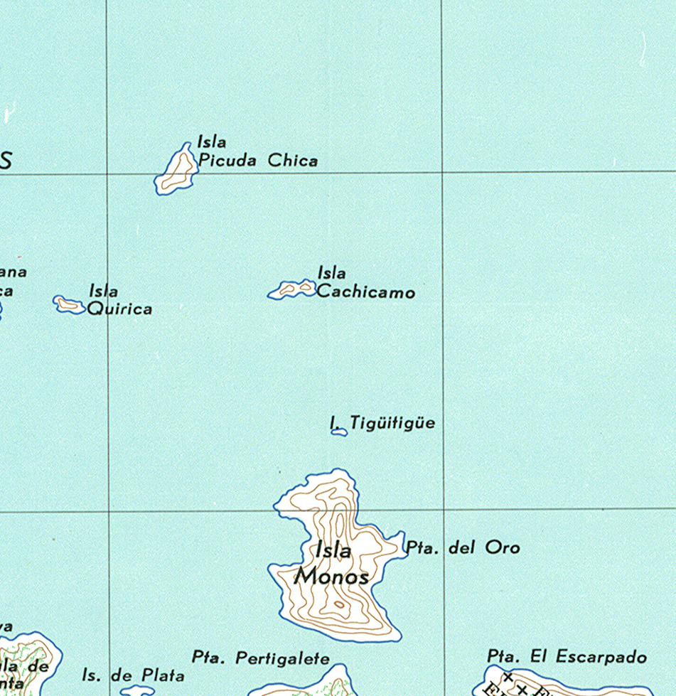 For its part, Isla Picuda Chica presents a markedly different spatial configuration, exhibiting a more compact, diamond or triangular geometry characterized by extremely sharp rocky edges that are difficult for boats to access. The inner surface of this formation is dominated by semi-arid terrain covered by creeping shrub vegetation that survives the harsh conditions of salinity and the lack of fresh water in the area. In the southeastern section of its territory, on one of its highest and most strategic natural promontories, sits the Picuda Chica Island Lighthouse, a marine navigation aid that is vital for ensuring safe maritime traffic for vessels traveling through the different channels of the national park.
The immediate geographic environment of the Picudas is complemented by minor formations and adjacent features such as the Tigüitigüi Islet, a small structure with a linear silhouette oriented from west to east that possesses a slightly greener central strip due to the accumulation of sediments that allow the growth of scrubland. This entire natural barrier of outer islands and islets functions as a protective shield that dissipates the energy of ocean waves, allowing the innermost areas located towards the mainland—such as the well-known Isla de Plata or Isla Los Monos—to enjoy remarkably calm waters, stable coastal plains, and white-sand bays that contrast drastically with the wild, rocky, and exposed nature of the Picudas Islands proper.
Member Islands
The archipelago consists of the following main islands, islets, and keys:
Name |
Area (hectares) |
Coordinates |
State |
|---|---|---|---|
Isla Los Monos |
187 |
Anzoátegui |
|
Picuda Grande |
90 |
Sucre |
|
Picuda Chica |
17.1 |
Anzoátegui |
|
Isleta Cachicamo |
6.9 |
Anzoátegui |
|
Isla de Plata |
3.5 |
Anzoátegui |
|
Isleta Quirica |
3.39 |
Anzoátegui |
|
Varadero |
1.9 |
Anzoátegui |
|
Isleta Tigüitigüi |
0.36 |
Anzoátegui |
See also
- List of islands of Venezuela
- Geography of Venezuela