
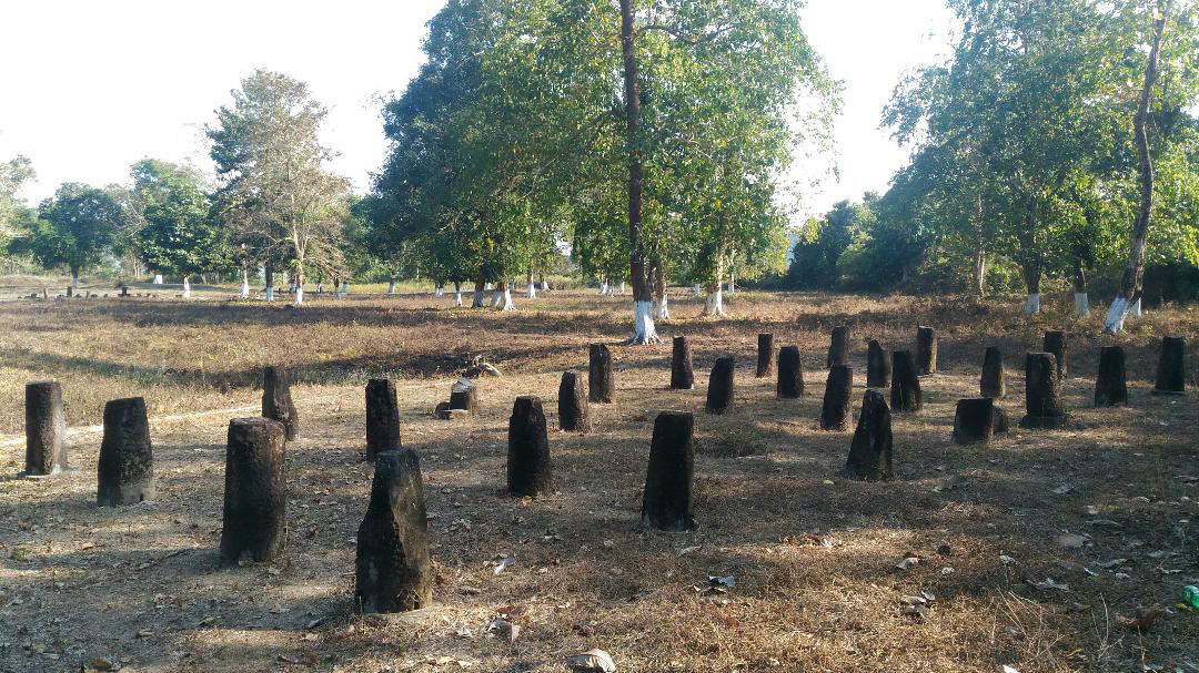
The Ramghat–Tarasso fortifications (also known as the Buroi fortifications) are the remains of a fortified settlement at Ramghat in the Tarasso circle of Papum Pare district, Arunachal Pradesh, India. The complex is situated in the foothills along the Buroi River, close to the Assam–Arunachal frontier. Surveys describe extensive earthen ramparts, stone defensive walls, gateways, brickwork, brick plinths and pillars of stilt houses. Scholars have associated the fortifications with the Chutia kingdom. Historian Nityananda Gogoi specifically used the archaeological remains of Ramghat-Tarasso, referred to by him as Buroi, in reconstructing the western and northern extent of the Chutia kingdom. Gogoi noted similar marks on stones at the archaeological remains of Sadiya, at the Buroi site and at Naxapahar, which he located near the confluence of the Bargang and Dikal rivers. On this basis, together with the Chutia inscriptions of the fourteenth and fifteenth centuries, he argued that the kingdom at times included parts of present-day Arunachal Pradesh and extended through the adjoining Brahmaputra valley towards Biswanath. The fortified settlement can be tentatively associated with the line of hill forts attributed to the Chutia king Gauri Narayan. According to the Chutia chronicles, Gauri Narayan, after consolidating his kingdom, “built a line of forts along the foot of the hills”, along with large tanks and temples.
Padum Pukhuri is an archaeological tank located in Sadiya in the Tinsukia district of Assam, India. It forms part of the archaeological landscape of Sadiya, the medieval centre of the Chutia kingdom, and has traditionally been associated with the Chutia rulers. Archaeometric analysis of a brick collected from the bank of the tank indicated that it had been fired above approximately 800 °C; luminescence dating of the sample produced broad early-medieval age estimates after correction for anomalous fading. A brick found on Padum Pukhuri bearing the name of the Chutia ruler Pratyakshanarayana independently indicates a Chutia-period phase of brick construction at the site.
Naksaparvat (also spelled Nakshaparbat) is a medieval archaeological site in Arunachal Pradesh, India. Located on the left bank of the Borgang River in the foothills of the Pakke-Kessang district of the East Kameng region, the site consists of a fortified settlement with an upper and lower habitation area, ring wells, a stone well, defensive stone and earthen ramparts, brick and stone plinths, stone posts or pillars associated with stilted house structures, structural remains, stone sculptured pillars, pottery assemblages and evidence of iron-working activity. It is known to have been built in the late medieval period between the 13th and 16th centuries, and is generally assigned to the Chutia kingdom. Historian Nityananda Gogoi specifically used the archaeological remains of Naksaparvat (referred to by him as Naxapahar) in reconstructing the western and northern extent of the Chutia kingdom. Gogoi noted similar marks on stones at the archaeological remains of Sadiya, at the Buroi site and at Naxapahar, which he located near the confluence of the Bargang and Dikal rivers. On this basis, together with the Chutia inscriptions of the fourteenth and fifteenth centuries, he argued that the kingdom at times included parts of present-day Arunachal Pradesh and extended through the adjoining Brahmaputra valley towards Biswanath. It was possibly built as a fortified foothills settlement similar to other sites like Ita Fort, Buroi, Gomsi, Rukmininagar, etc. The fortified settlement can be tentatively associated with the line of hill forts attributed to the Chutia king Gauri Narayan. According to the Chutia chronicles, Gauri Narayan, after consolidating his kingdom, “built a line of forts along the foot of the hills”, along with large tanks and temples.
Naksaparvat is among the few medieval sites in Arunachal Pradesh that have undergone systematic excavation and is considered important for understanding settlement patterns, fortification systems and material culture in the eastern Himalayan foothill region.
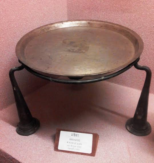
Maihang is a traditional raised metal plate used in Assam for eating food. It is a type of plate with a stem, stand or holder, and is generally made of bell metal. A similar raised plate, known as the "ban-kahi", differs from the "maihang" in that the latter is supported by three legs forming a tripod vessel, whereas the former rests on a single pedestal. Comparable tripod plates or ritual vessels are also found in Nepal, Tibet, and South India., where such forms are associated with Buddhist and Hindu ritual practices.